NDVI(Normalized Difference Vegetation Index)
Compares red and near-infrared reflectance. It is commonly used as an indicator of vegetation greenness and density. A drop or uneven pattern over time can help flag a change that may merit inspection.
Agribid Intelligence is a digital farming product. This platform provides crop cultivation schedules, timely farming tasks and field monitoring generated from agronomy templates reviewed by agronomists and supported by satellite and weather information. It is presented as part of Agribid’s wider digital agriculture offering, which also serves farmers, FPOs and other agricultural organizations.
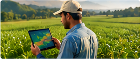
A satellite-monitoring workflow generally starts with a farmer or organization adding a field boundary and identifying the crop and planting date. Satellite observations can then be matched to the field over time, with imagery and derived indicators used to highlight areas that appear to be developing differently.
A field report could include:
Compares red and near-infrared reflectance. It is commonly used as an indicator of vegetation greenness and density. A drop or uneven pattern over time can help flag a change that may merit inspection.
Uses near-infrared and red-edge reflectance. Red-edge bands can be useful for examining canopy and chlorophyll-related variation, particularly in denser vegetation. Its availability depends on the imagery source and processing used.
For example, if one field has lower vegetation readings than an average reading, a farmer can inspect for poor germination, water stress, weeds, pests, disease or soil differences. The index helps identify where to look; it cannot determine the exact cause by itself.
These indices are indicators, not a diagnosis. Crop type, growth stage, soil background, cloud cover and other conditions can affect the reading.
Satellite observations can be combined with weather information and a crop calendar to give context to field changes. Potential applications include:
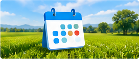
The cultivation schedules and farmer tasks are generated from approved agronomy templates reviewed by agronomists. A practical schedule may organize work by crop stage—for example, land preparation, sowing, irrigation, nutrient application, scouting and harvest—then show the relevant task and timing to the farmer.
Recommendations are localized to crop, variety, planting date, and current field conditions.

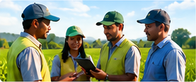
Useful insights for every stakeholder
Put field insights to work
Use a change in vegetation condition to decide where a farmer should inspect first.
Use the cultivation schedule to coordinate field visits or farmer reminders around expected activities.
Review weather evidence when planning field work, while confirming local conditions before acting.
Group member fields by crop and activity period to organize extension support.
Compare available field observations and task records to inform planning for a later crop cycle.
Agribid Intelligence covers major crops currently grown across India. Coverage will expand progressively to include minor crops.


| Field | Crop and stage | Example observation | Suggested follow-up |
|---|---|---|---|
| Field A | Maize, vegetative stage | Most of the field shows a steady vegetation trend; one section is lower than the rest | Scout the lower-trend section and check for water, soil or crop-establishment differences |
| Field B | Wheat, early growth | Recent weather may affect the timing of planned field work | Check local field conditions and adjust the task date if needed |
| Field C | Pulses, flowering | A scheduled crop-stage task is approaching | Review the agronomy guidance and confirm the crop stage before carrying out the task |
Get satellite-based field insights, crop schedules and expert-backed recommendations for your farm or organization.
© Copyright 2026 by Agribid.ai